Description
How to Purchase
✅ Instant Delivery (No Physical Delivery Required)
✅ Before you buy, make sure you read the Terms and Conditions
✅ If you agree to buy, you have agreed to the terms and conditions of no refunds if the reason is as described Terms and Conditions
✅ License for one PC, and cannot be transferred to another PC
✅ Active Period: Lifetime (can reinstall)
✅ Support: Windows 10, 11
✅ Update Application: No
✅ Install Instructions: Available (video/text)
✅ It should be noted, buying = understanding product use
Note:
Files & Prices may increase or decrease at any time
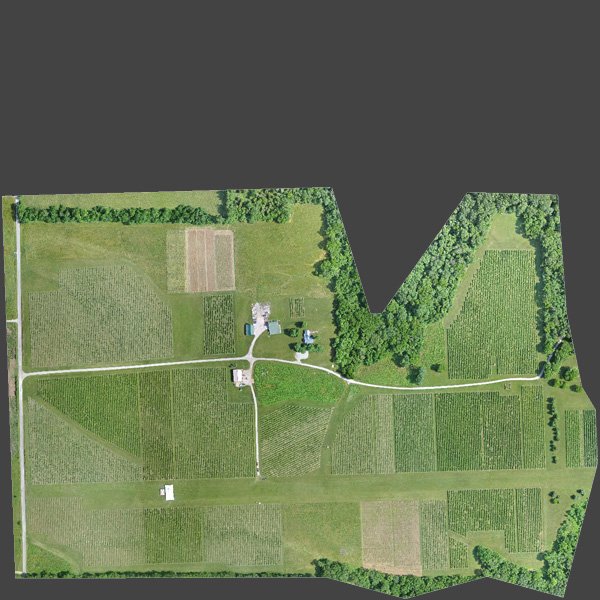
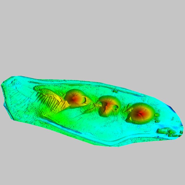
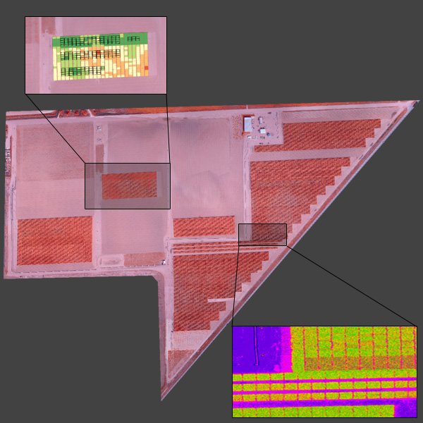
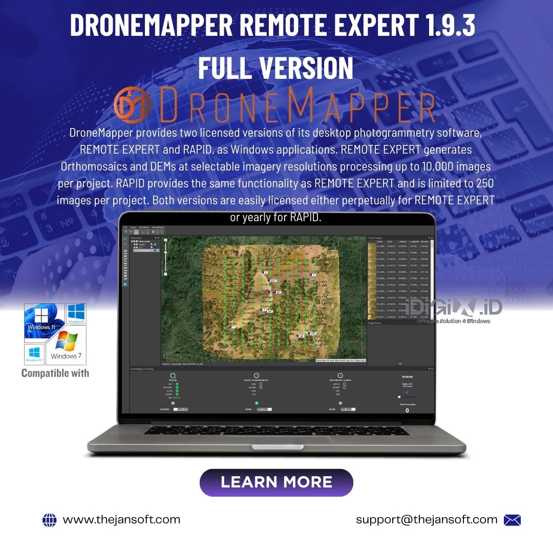
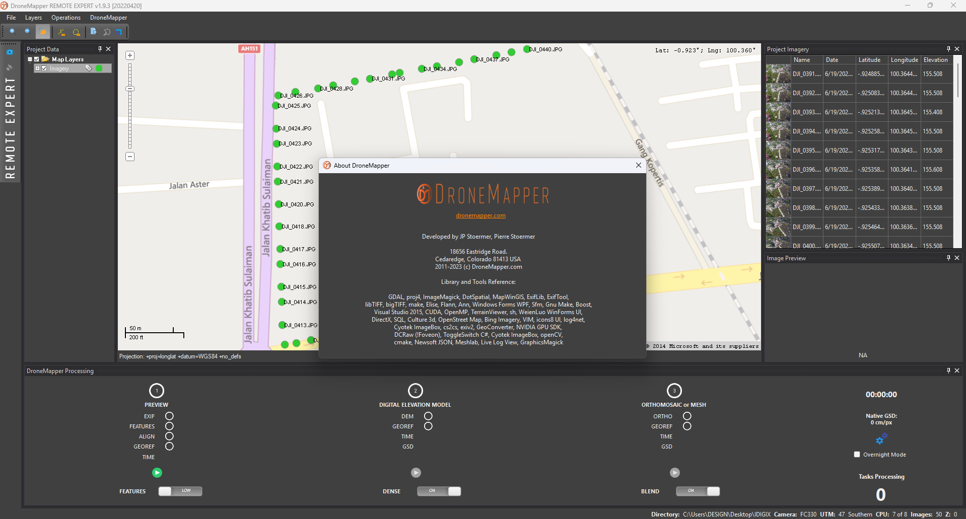
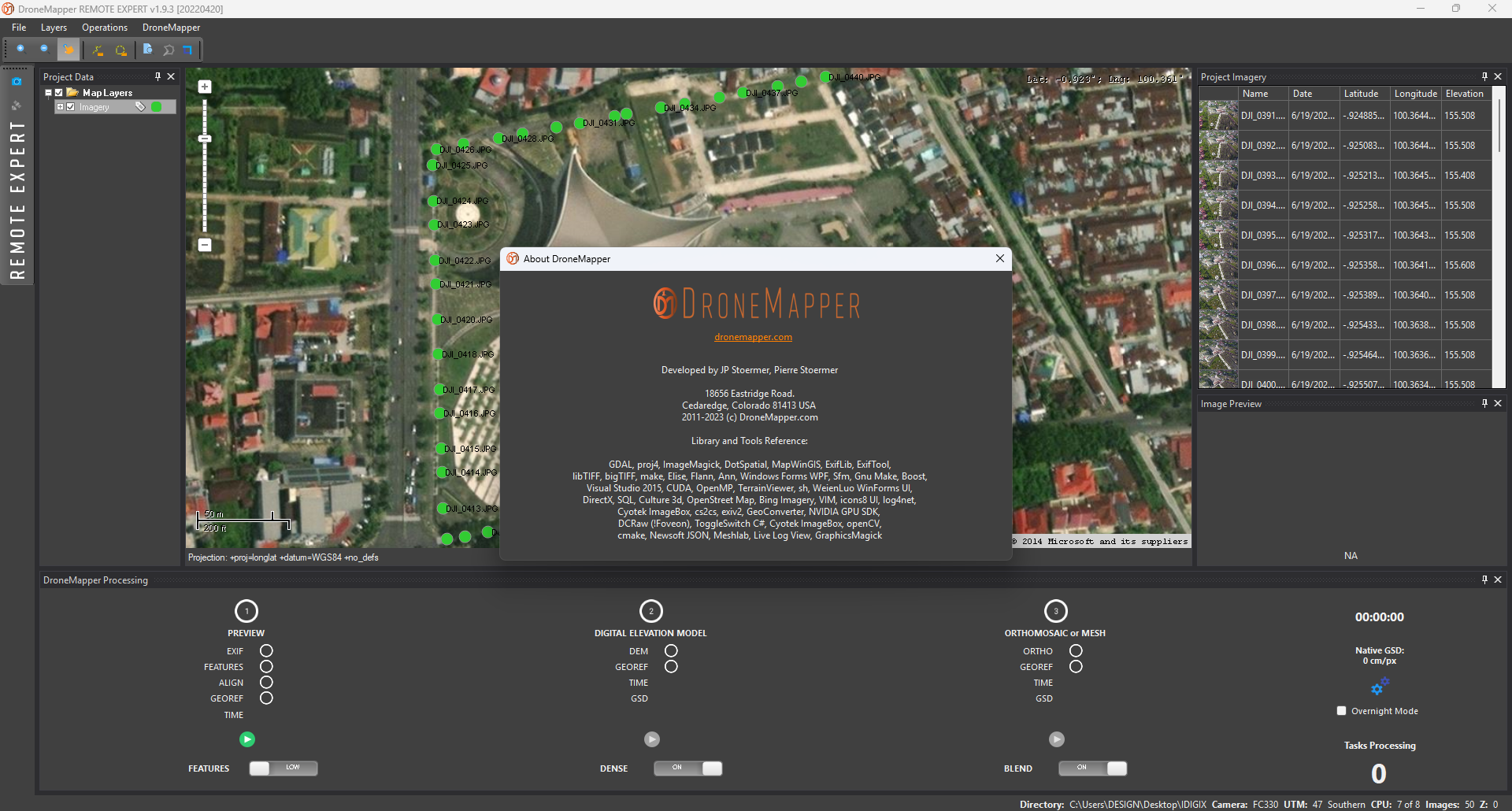
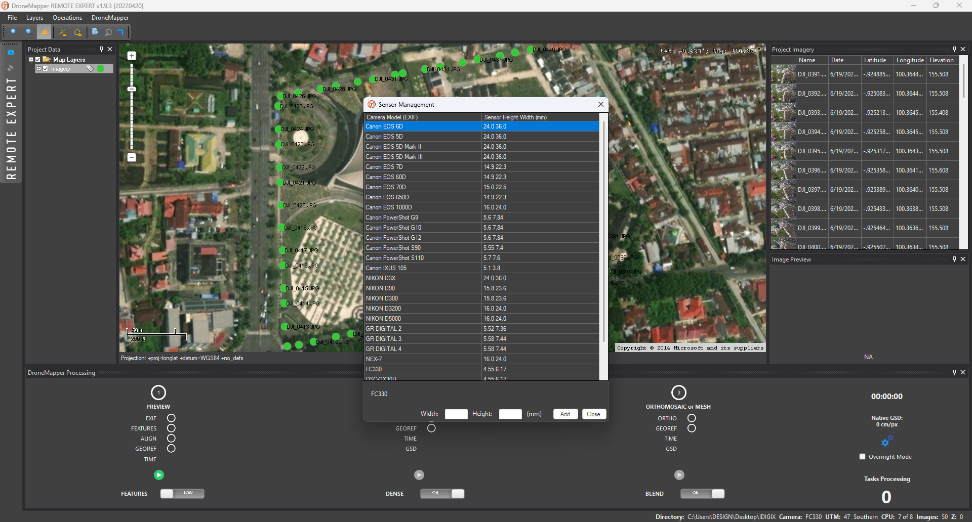
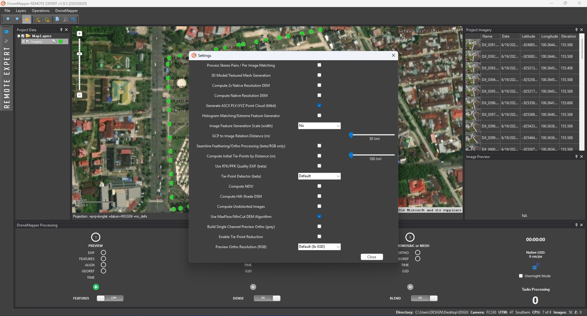
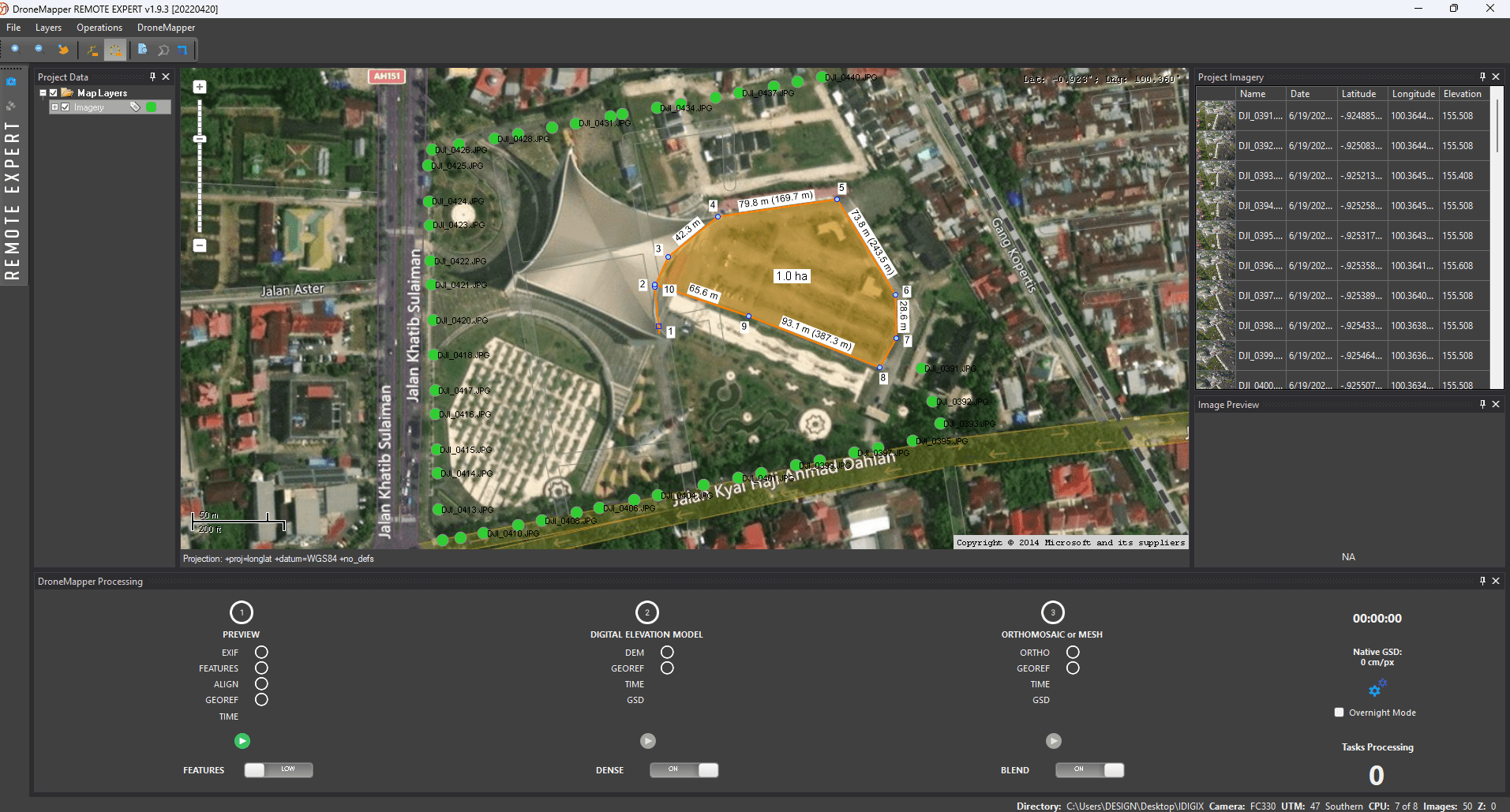
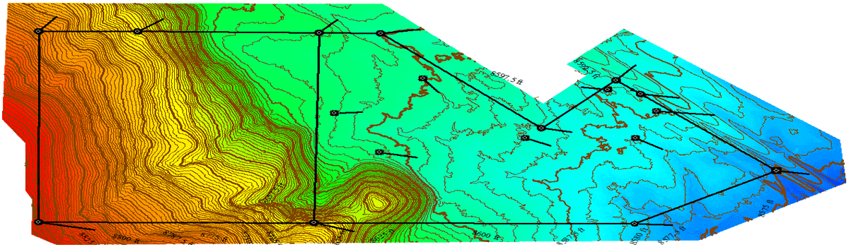
Drone Mapping Software, Cloud Processing, AgTech, Flight Operations, Land Survey and GIS Services
We are an innovative company specializing in photogrammetry and the extraction of value-added products from your imagery. We generate georeferenced Orthomosaics, Digital Elevation Models (DEMs), Digital Terrain Models (DTMs), point clouds, textured mesh 3D models and GIS products for a large set of market segments. We operate a Software as a Service (SaaS) system, provide licensed desktop software, conduct manned and unmanned aerial imagery collections and provide consultation and training specific for your application(s). Please review some of the use cases on the site and feel free to contact us for questions and discussion.
Reviews
There are no reviews yet