Description
How to Purchase
✅ Instant Delivery (No Physical Delivery Required)
✅ Before you buy, make sure you read the Terms and Conditions
✅ If you agree to buy, you have agreed to the terms and conditions of no refunds if the reason is as described Terms and Conditions
✅ License Unlimited, Can be installed on many PCs
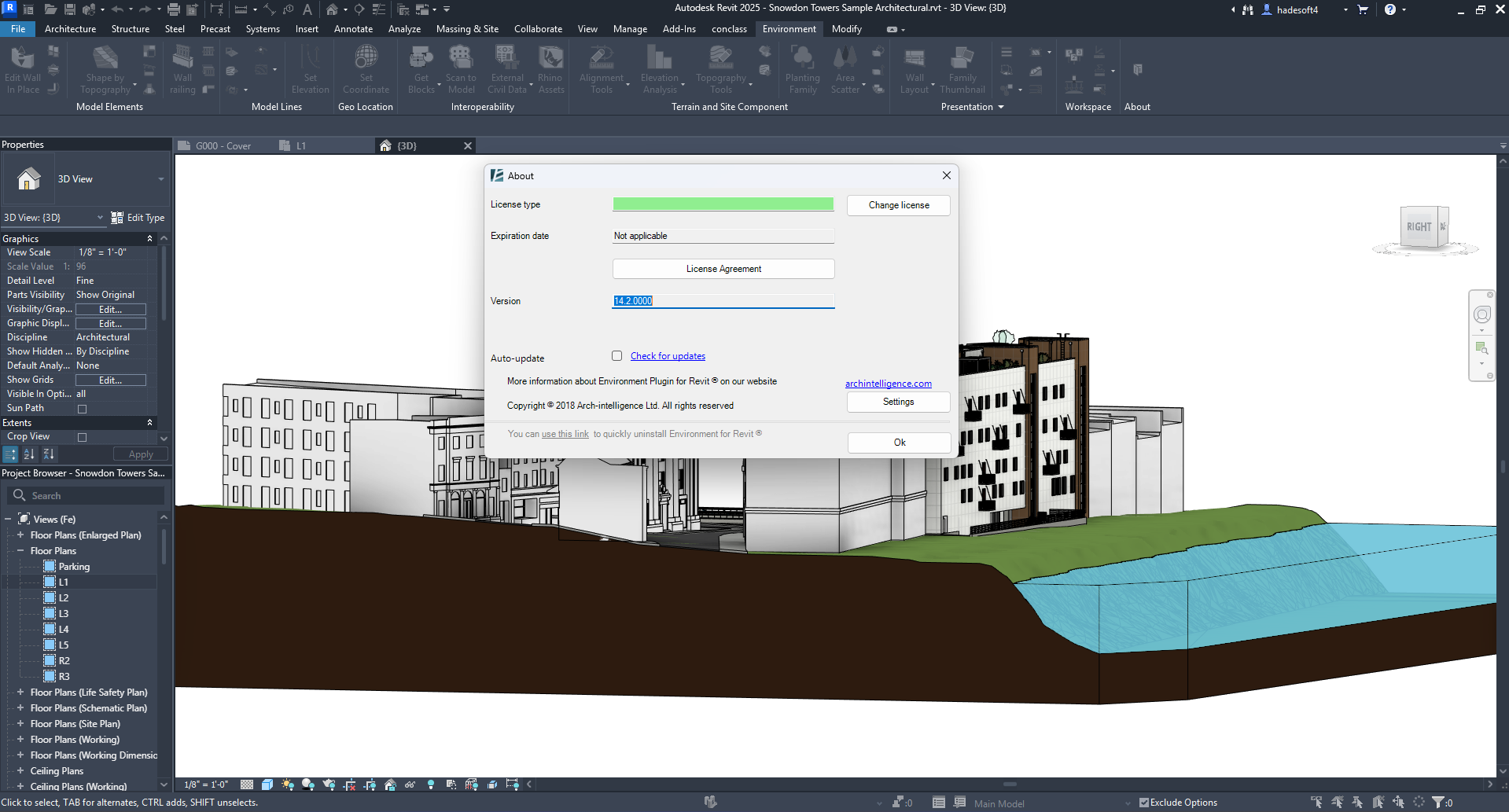
✅ Environtment for Revit v.14.2 update 10 may 2025
✅ Active Period: Lifetime (can reinstall) warranty for 1 years support
✅ Support: Windows 10, 11
✅ Support for REVIT 2020-2026
✅ Update Application: No
✅ Install Instructions: Available (video/text)
✅ It should be noted, buying = understanding product use
Note:
Files & Prices may increase or decrease at any time
Environtment for Revit v.14
Compatible with:
- Autodesk Revit
- Version: 2026 , 2025 , 2024 , 2023 , 2022 , 2021 , 2020
Environtment for Revit v.13
Compatible with:
- Autodesk Revit
- Version: 2024 , 2023 , 2022 , 2021 , 2020
10-May-2025
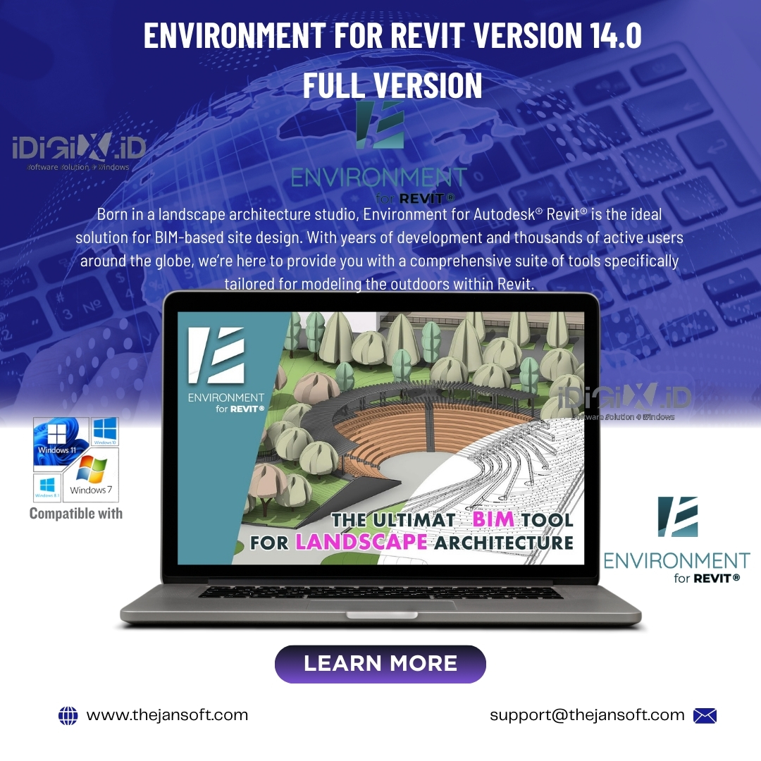
Environment for Revit Version 14.2
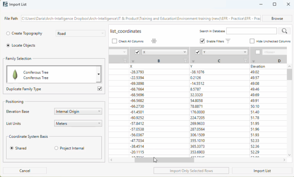
| Import List | Import data from an Excel spreadsheet to create topography or to place Revit family instances at specified coordinates and automatically populate the instance parameters of the placed elements based on the data in the spreadsheet. |  |
Read more… |
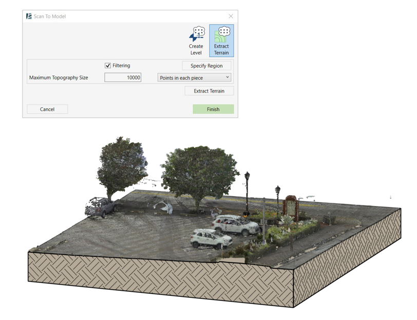
| Scan to Model | Set of tools to facilitate modeling from Point Cloud. This includes automatic creating of topography, level recognition, and more. |  |
Read more… |
| Rotate Element | Rotate one or few elements in the model around their axes. You can set a precise rotation angle or allow random rotation. |
 |
Read more… |
| Update Wall Layout | Update an Elevation View previously created using the Wall Layout tool. Instead of rerunning the WALL LAYOUT tool and generating new detail items and elevation views, it simply updates the existing ones, saving you time and reducing unnecessary rework. |
 |
Read more… |
| Export LandXML | Export LandXML tool received long awaited upgrade. You can now select multiple surfaces at once (top or bottom face). |  |
Read more… |
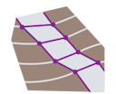
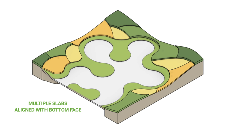
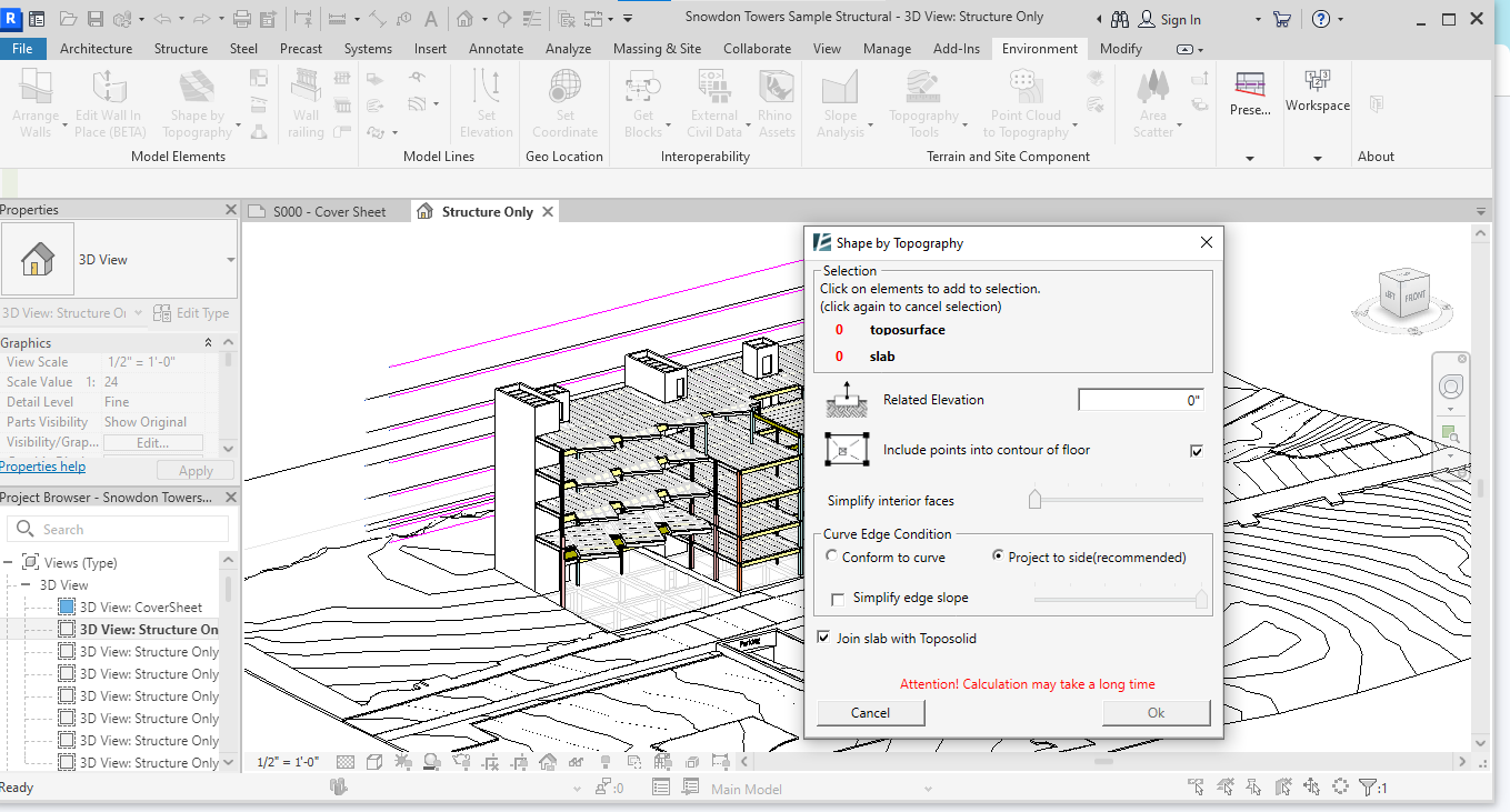
| Shape by Topography | The Shape by Topography tool now includes the new ALIGN WITH feature, which takes into account the structure of a slab. It is especially valuable when designing vegetation as it ensures cleaner, more accurate geometry with minimal manual adjustment. |
 |
Read more… |
Smarter, faster, and packed with new tools!
Like every new release, Environment for Revit v14 comes with bug fixes and performance enhancements.
But this time, several key updates and exciting new features that truly shine!
🌟HIGHLIGHTS🌟
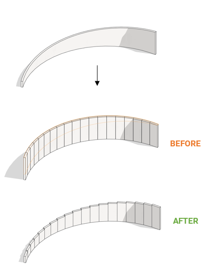
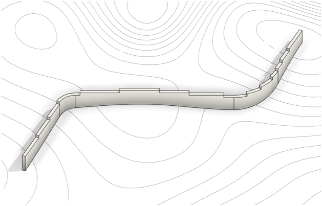
 APPROXIMATE WALL PATH
- Major performance boost
- Now supports walls with sloped profiles
If a wall has been modified to be sloped, the Approximate Wall Path will now accurately follow that adjusted profile, trimming walls precisely to match the altered slope.
For a detailed explanation of this feature, visit the Approximate Wall Path user guide.

 ARRANGE WALLS
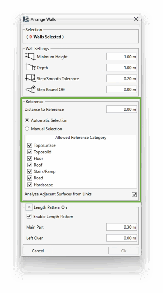
- Completely redesigned interface
- Now supports wall selection directly in the tool
- Supports references from Revit links
- Expanded reference categories
- Improved performance
The Arrange Walls tool has been completely redesigned to offer a smoother experience, allowing users to select walls directly within the tool while supporting linked Revit reference surfaces and expanding the range of reference categories (such as Roads and Hardscapes).
For a detailed explanation of this feature, visit the Arrange Walls user guide.
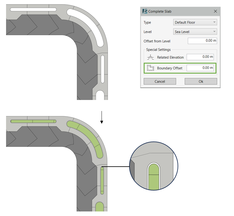
 COMPLETE SLAB
- Added Boundary Offset option NEW
- Faster and smoother operation
The Complete Slab tool now includes a new Boundary Offset option, making it much easier to create curbs and retaining edges without the need for additional steps when generating inner slab infills.
For a detailed explanation of this feature, visit the Complete Slab user guide.
 EXPORT LandXML
- You can now select multiple surfaces at once (top or bottom face) NEW
- Enhanced export speed and stability
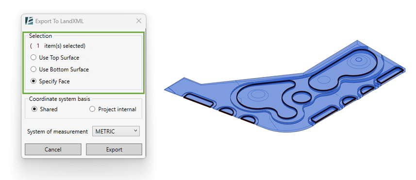
The Export LandXML function allows you to export surface data, such as topography top/bottom faces, from your Revit model into LandXML format for use in civil engineering and site design software. This new ability to select multiple surfaces at once streamlines the collaboration process in complex projects.
For a detailed explanation of this feature, visit the Export LandXML user guide.
 GET BLOCKS
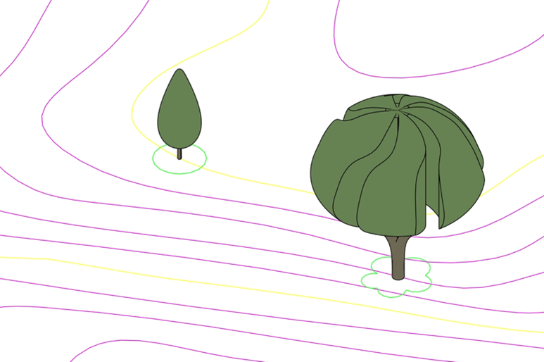
- Redesigned interface
- Smoother workflow when importing multiple block types
- More intuitive duplication of block types
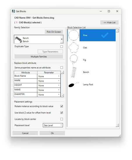
The Get Blocks tool streamlines the process of importing and managing CAD blocks thanks to the redesigned interface. You can now import multiple blocks in one go and duplicate them more intuitively.
This update is especially useful when working with large, repetitive elements, making the setup of complex models faster and more organized.
For a detailed explanation of this feature, visit the Get Blocks user guide.

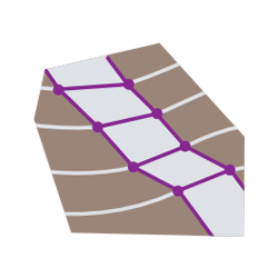 SHAPE BY TOPOGRAPHY
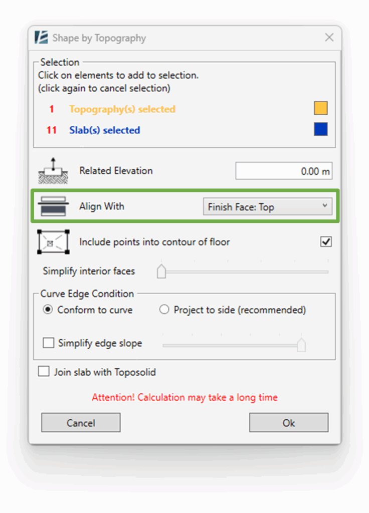
- Introducing the “Align With” feature for precise shaping NEW
- Performance improvements
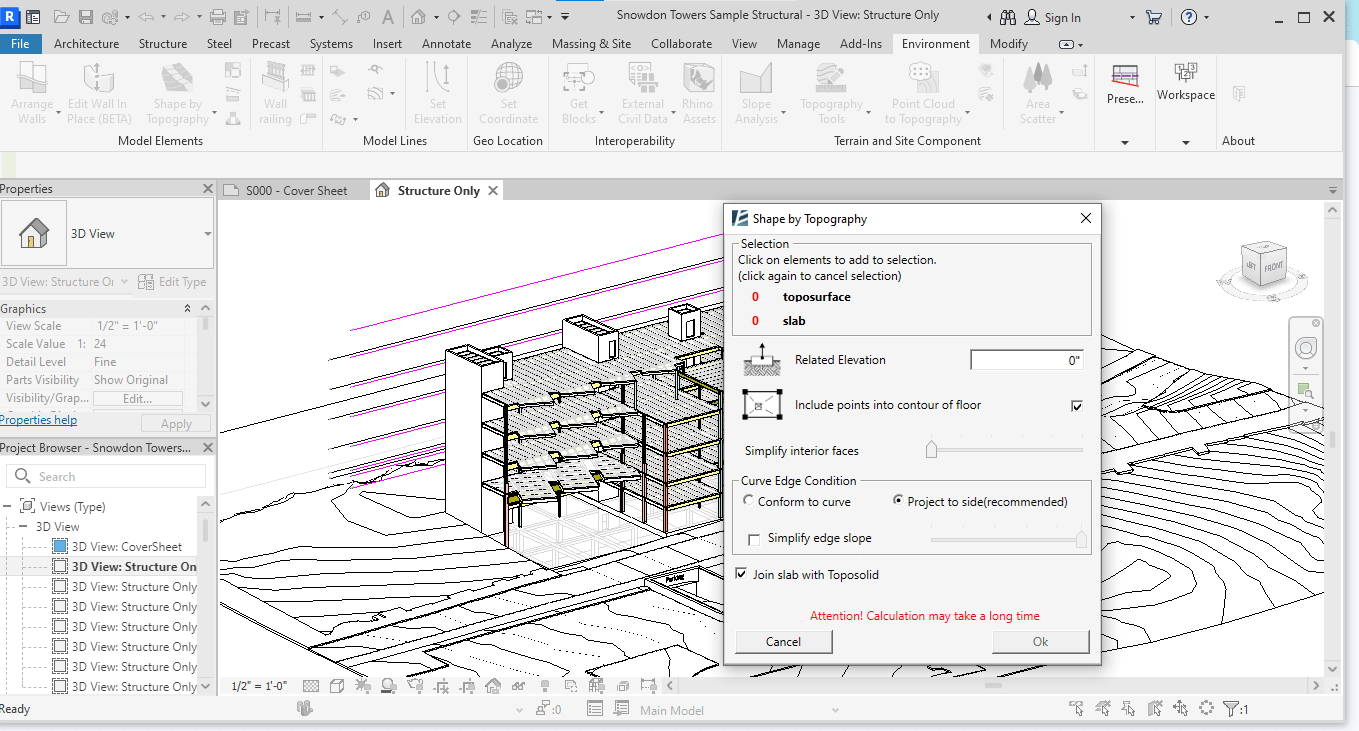
The Shape by Topography tool now includes the new Align With feature, allowing you to precisely match elements (like toposolids, floors, or roofs) to the shape of a topographic surface.
It is especially valuable when designing softscapes and vegetation as it ensures cleaner, more accurate geometry with minimal manual adjustment.
For a detailed explanation of this feature, visit the Shape by Topography user guide.
 SNAP WORKPLANE
- Introducing the “Precise Work Plane Elevation” feature NEW
The updated Snap Work Plane tool introduces the Precise Work Plane Elevation feature, allowing you to define the exact elevation of your work plane with full precision.
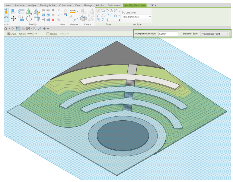
This is particularly useful for drawing lines at specific heights, ensuring greater control and consistency in your model.
For a detailed explanation of this feature, visit the Snap Workplane user guide.
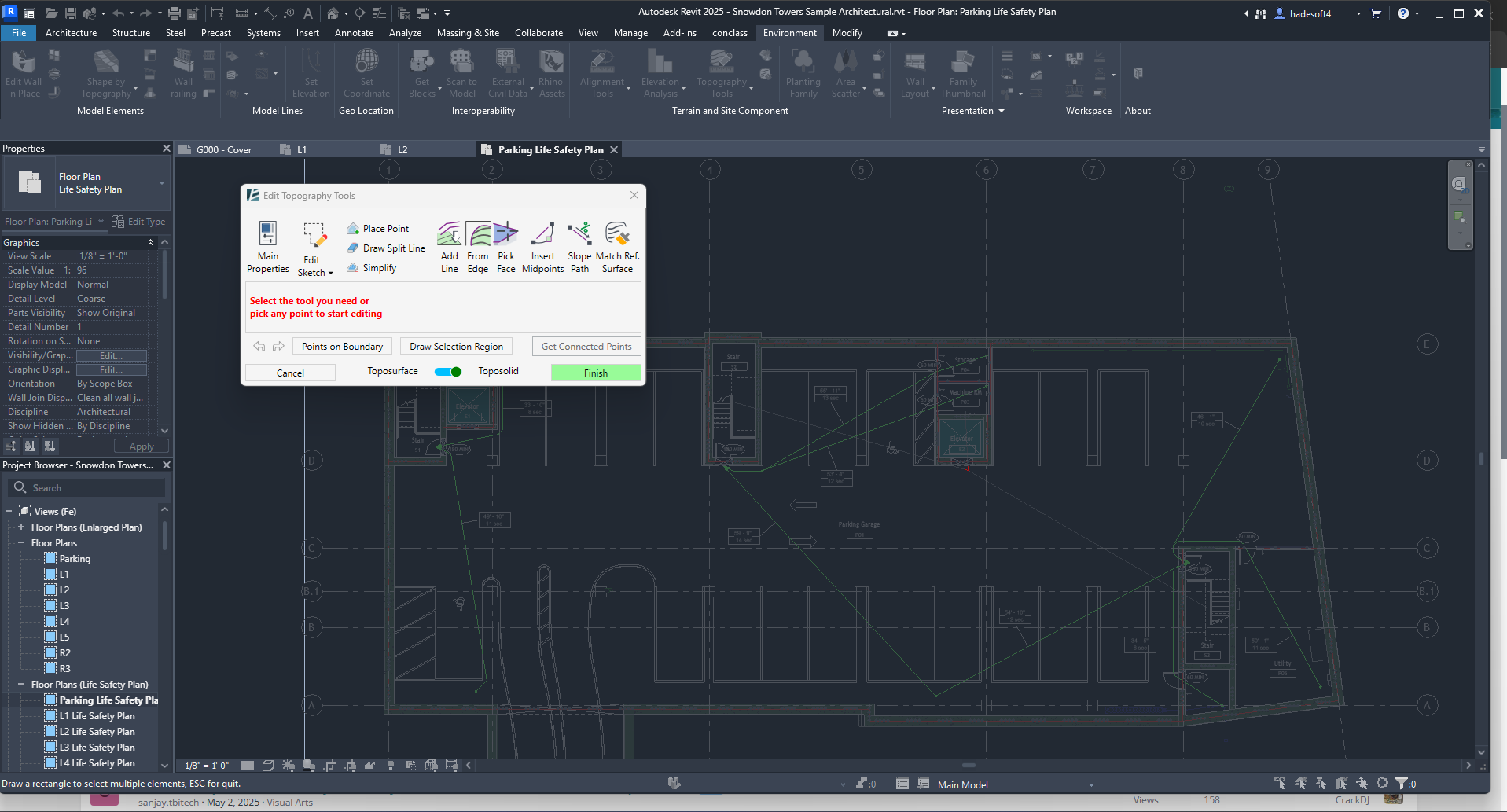
 TOPOGRAPHY TOOLS (Revit 2024 and newer only)
- Import points from any spreadsheet file using the “Import List” feature NEW
- Support for split lines in toposurfaces
- New interface for Edit Sketch
- Performance enhancements

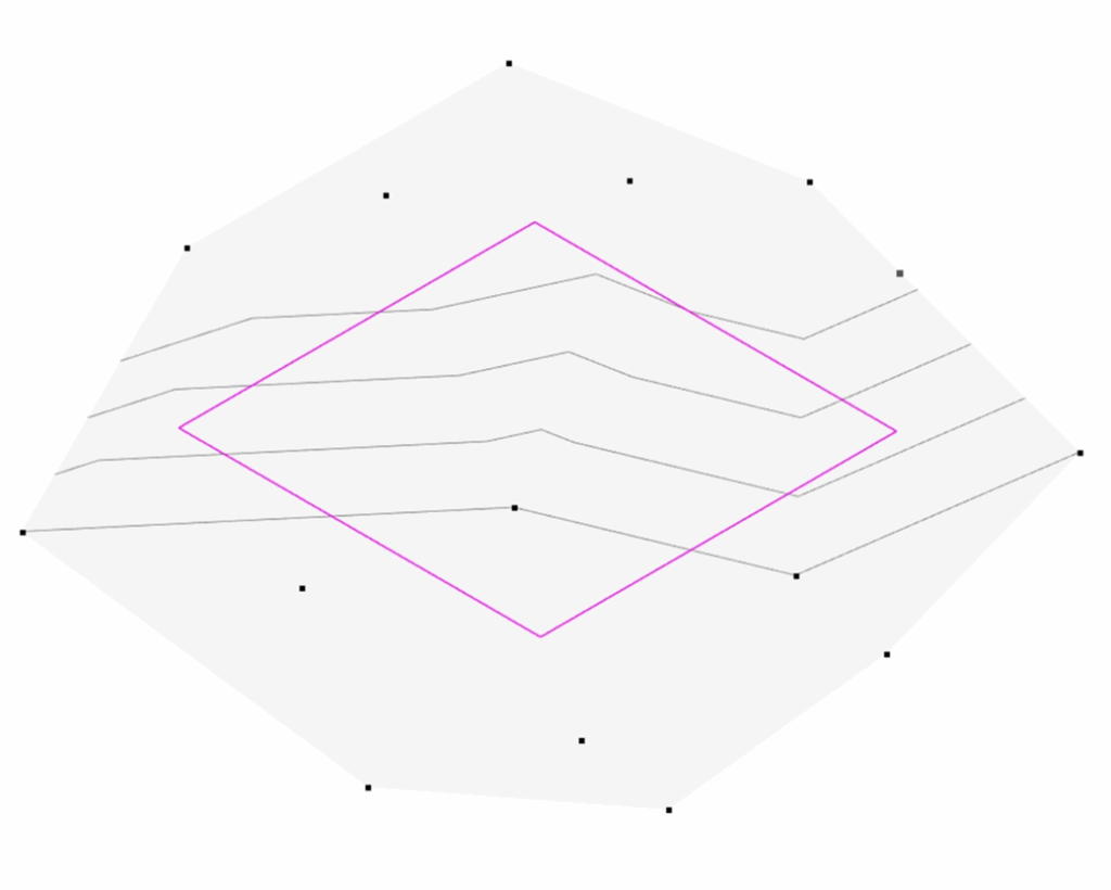
With the Import List feature, you can now convert data from any spreadsheet file into Revit elements. This tool works with XLSX, XLSM, CSV, and XML file formats, making it easy to generate accurate topographies from survey data.
Support for split lines allows for better control over surface divisions and grading logic. Combined with a redesigned Edit Sketch interface and improved performance, these enhancements make site modeling even more precise, flexible, and efficient.
For a detailed explanation of this feature, visit the Topography Tools user guide.

 WALL LAYOUT
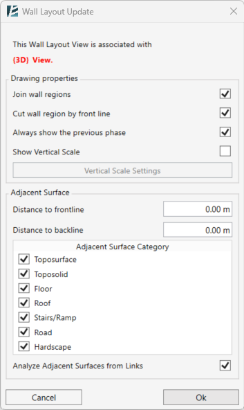
- Fresh new interface
- Introducing the “Vertical Scale” feature NEW
- Select walls directly within the tool
- Supports references from Revit links
- Expanded reference categories
- Improved speed and reliability
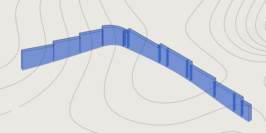
The refreshed Wall Layout tool now features a more intuitive interface and introduces the Vertical Scale option for improved documentation.
With the ability to select walls directly within the tool, support for Revit links, and expanded reference categories, it’s easier than ever to create an unfolded view of a wall for precise coordination and documentation.
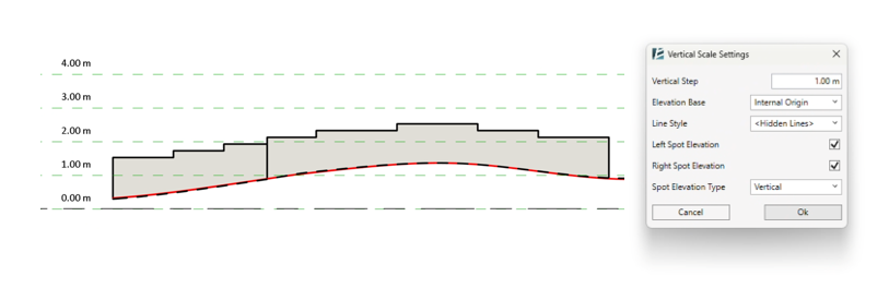
For a detailed explanation of this feature, visit the Wall Layout user guide.

🆕 NEW TOOLS INTRODUCED 🆕
 IMPORT LIST
convert data from any spreadsheet file into topography or Revit elements.
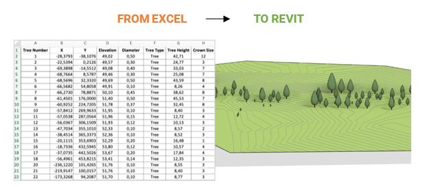
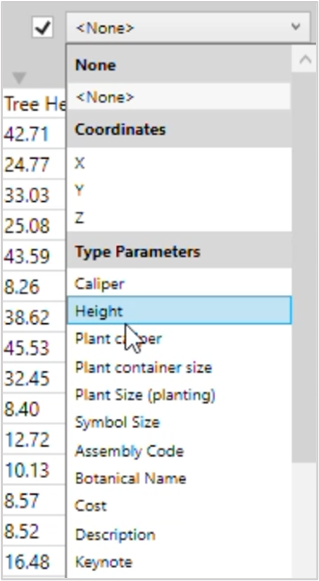
The new Import List tool allows you to place elements (and Topographies) in your model based on a predefined list of coordinates and parameters. You can import not only the element’s coordinates, but also type and instance parameters directly into the families, enabling precise, data-driven modeling. This tool works with XLSX, XLSM, CSV, and XML file formats. This streamlined workflow reduces manual work, improves consistency, and ensures your elements come into the model exactly as specified.
For a detailed explanation of this feature, visit the Import List user guide.

 ROTATE ELEMENTS
a quick way to rotate multiple elements with control
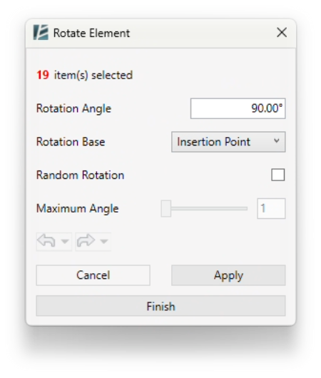
The new Rotate Elements tool offers a fast and controlled way to rotate multiple elements at once.
It’s especially useful for site elements, furniture, or repetitive components that need to follow a specific orientation pattern, saving time and ensuring precision across the model.
For a detailed explanation of this feature, visit the Rotate Elements user guide.

 SCAN TO MODEL
replaces legacy “Point Cloud to Topography” tools
The Scan to Model tool replaces the Point Cloud to Topography tool, providing an advanced method for extracting topography directly from point cloud data.
This tool also contains a new Create Level feature that automatically recognizes and generates levels from the selected point cloud.
Scan to Model tool streamlines the process, saving time and improving accuracy, especially when working with large, complex scans.
For a detailed explanation of this feature, visit the Scan to Model user guide.
 UPDATE WALL LAYOUT
easily update the layout without recreating geometry
The Update Wall Layout tool allows you to quickly update your elevation created with the “Wall Layout” tool without the need to recreate geometry from the beginning. Very useful when design changes affect your wall layout. Instead of rerunning the “Wall Layout” tool and generating new detail items and elevation views, it simply updates the existing ones, saving you time and reducing unnecessary rework.
For a detailed explanation of this feature, visit the Update Wall Layout user guide.
⚠️Discontinued / Replaced Tools
![]() Locate Objects → now part of the
Locate Objects → now part of the ![]() Import List tool
Import List tool
![]() Pointcloud to Topography → replaced with
Pointcloud to Topography → replaced with ![]() Scan to Model
Scan to Model
![]() Topography from CSV → merged into
Topography from CSV → merged into ![]() Import List
Import List
![]() Wall Layout Settings → integrated into the Wall Layout tool
Wall Layout Settings → integrated into the Wall Layout tool
Version 14 represents a significant step forward in making Environment for Revit faster, more powerful, and more intuitive. Whether you’re shaping complex topographies or managing intricate wall systems, this release is designed to make your workflow smoother than ever.



Reviews
There are no reviews yet